Global Mapper 12 + Rus

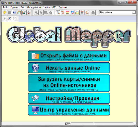
Global Mapper - это универсальная программа, позволяющая просматривать, конвертировать, преобразовывать, редактировать и распечатывать различные карты и векторные наборы данных. Ваши данные могут быть загружены в качестве слоев, или быть загружены как отсканированная топографическая карта для 3D изображения местности. Программа может работать в реальном времени, загружая данные с присоединённого к компьютеру GPS приёмника. Global Mapper поддерживает огромное количество форматов, имеет много различных инструментов и опций. С ее помощью можно подсчитывать расстояния от одного объекта до другого, подводить контуры изображения, настраивать контрастность и многое другое.

Возможности программы:
- Поддержка просмотра основных форматов данных
- Прямой доступ к DigitalGlobe, TerraServer-USA, WMS и другим источникам
- Поддержка просмотра 3D ландшафтов
- Обрезание, перепроектирование и слияние любых комбинаций растровых данных и данных возвышенностей
- Оцифровывание новых векторов с возможностью их перемещения
- Совместимость с GPS устройствами через компьютерный серийный порт или USB порт
- Поддержка конвертации между большим списком проектных систем и исходных данных
- Экспорт в векторные и растровые данные
- Графическое исправление любых JPG, TIFF или PNG изображений и сохранение результатов в новое изображение
- Создание контуров для любых комбинаций данных возвышенностей
- Загрузка и отображение JPG изображений со встроенными EXIF данными о позиции
- Поддержка NASA World, Google Maps, Virtual Earth
- И многие другие возможности
What's New in This Release:
- Added built-in access to the NAIP color high-resolution imagery for the entire United States via the File->Download Online Imagery/Data menu command.
- Added built-in access to the ASTER GDEM terrain data at 1.5 arc second (~45m) resolution for the entire world via the File->Download Online Imagery/Data menu command.
- Added built-in access to premium Parcel data for the entire US via the File->Download Online Imagery/Data menu command.
- Added support for automatically delineating stream networks and watershed areas using loaded terrain/DEM data using the File->Generate Watershed menu command.
- Added 'Point Styles' tab to Options dialog for vector layers with point features allowing users to setup the styling of points in a layer. Now users can use the default type-based styling, apply a single style to all point features in a layer, setup an attribute-based styling system that styles the points based on the value of an attribute value or the display label, or randomly assign colors to the dot or custom symbols for points in a layer.
- Updated the Download Online Imagery/Data interface to group data sources to allow easily finding data sources of a particular type or covering a particular area.
- Updated the Control Center to support assigning groups to selected layers via the right-click menu. Those groups can then be collapsed in the Control Center to allow easily selecting, closing, or hiding/showing that group.
- Added new right-click option to the Digitizer Tool for creating a regular grid of areas anchored at some point and of user-specified size, rotation angle, and naming.
- Added ability to export BIL/BIP/BSQ and JPEG2000 raster files with multiple bands of data at 8, 16, or 32-bit depth (similar to what was possible before for GeoTIFF exports).
- Added option to use halo fonts for text display. Halo fonts display a thin border around text of a slightly different color, making the text visible on any background.
- Updated the export interface to replace the long sub-menus with dialogs allowing format selection to prevent overflowing the export format lists off of the screen.
- Updated the map legend display based on vector types to allow labeling each style in the legend by the feature type, name, or any attribute value, in addition to the feature description which is what was always used before.
- Added new EDIT_VECTOR script command (replacing the ASSIGN_TYPES command) to allow adding/updating feature attributes values and display labels, reclassifying features, rotating/scaling/offsetting feature coordinates, or marking features as deleted by searching loaded features for matches against their attributes/label values and/or types.
- Added support for loading HCRF marine chart files, including the ARCS chart series from the UKHO.
Скачать программу Global Mapper 12 + Rus (46,68 МБ):
Bukkollaider 13/10/10 Просмотров: 6225
0


Спасибо за релиз. Давно искал нечто подобное, так сказать - для лентяев, чтобы было "всё в одном".
если ручки не волосоатые, то можно сделать так- установир-руссифицировал,кряк - и сим-салабим- все робит как часы!!!!!!!
Прошу исправить регистрацию для русифицированной версии
Почему не проверяйте работу программы перед её выкладыванием сдесь.
В данном комплекте работает либо русификация, либо таблетка.
Если русифицируешь, то получаешь незарегистрированную версию программы
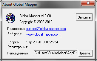
Прощу обратить внимание на первый скриншот, на котором видно, что русификация и регистрация прошла. Все программы выложенные мной, я сначала устанавливаю у себя, только потом выкладываю
крак не работает....
Как ввести file_id?